How did 10-way highway in the center of Moscow
• How did 10-way highway in the center of Moscow
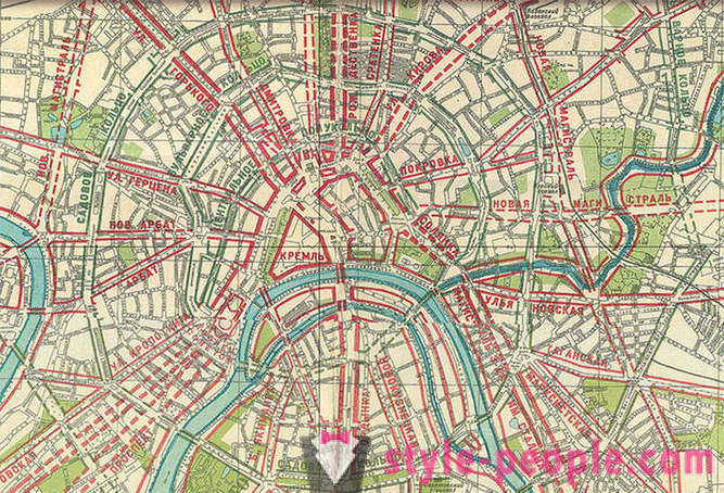
Today will discuss the reason for having 8-10 Way highway in the heart of the capital. They appeared in the late 30-ies of XX century, according to the general plan of development of Moscow in 1935. This plan is meant a large-scale restructuring of the capital of the Soviet Union, during which she was supposed to be a showcase featuring the best parties of the socialist way of life. In the course of this "reconstruction" of killing such monuments as the Kitai-Gorod wall with Iberian Gate, Sukharev Tower, Red Gate, the Triumphal Arch, the Temple of Christ the Savior, and so much more. Something later replaced remake, but agree that it is not the same ...
But back to the highways in central Moscow. According to the general plan of many narrow streets had to expand to 30-40 meters and turn into a very broad avenues:
Let's start with the main street Tverskaya / Gorky capital. That's how it looked before reconstruction. Yes, yes, it's Tverskaya!
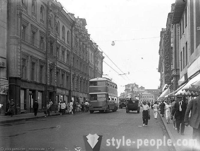
A narrow roadway and narrow sidewalks could not cope with the needs of an increasing population. Street, of course, had to be changed, but not extend the same to 10 lanes (just for this and moved the houses in the thirties)!
By the way, the original is not the whole roadway was given to cars. Look, what was the dividing line baggy.
30 years Please note the lack of green spaces. They came, but much later
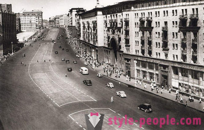
Over time, the machine itself pushed forward more and more space on the road. Dividing line becomes narrower. There were trees and preserved ground pedestrian crossings
50s
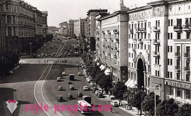
And here is another historic photography (2012). Gone are not only trees, but also sculptures on houses (they are prevented anyone?).
verskaya blocked for the passage of the next tuple
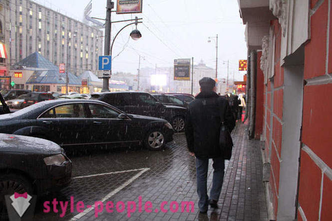
Instead of green space on the sidewalks appeared parking for cars. Fortunately, since last year began to deal with this mess. Although recently the sidewalks were as follows:
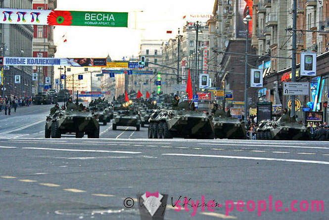
Broad Street is very good for parades that before ...
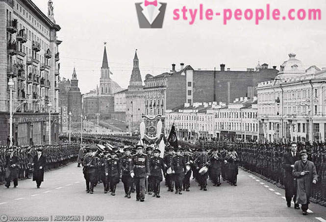
1947
... what now:
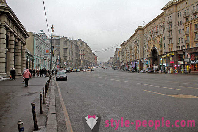
But in normal life wide highway abutting the Kremlin - is absurd!
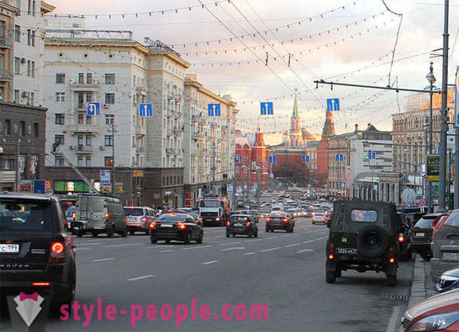
Do we really vital 10-way Tver near the Kremlin?
Now the whole flow of cars goes to the one-sided 10-band Theater Lane. According to the general plan of this idiocy is not supposed to be planned over the worst option ... Red Square was supposed to become a transit highway connecting Varshravskoe and Leningrad highway (see. The master plan)! Big Ordynka as Tverskaya Street would be a 8-lane road. And St. Basil planned to demolish how to stop the movement of the car!
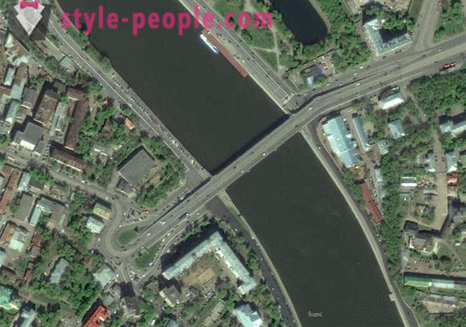
The implementation of these plans has prevented World War II. But in 1938 for future highways through the center of Moscow managed to construct / reconstruct three bridges: Large Ustyinsky, Moskvoretsky Big, Big Stone. Here they are, all three, right to left.
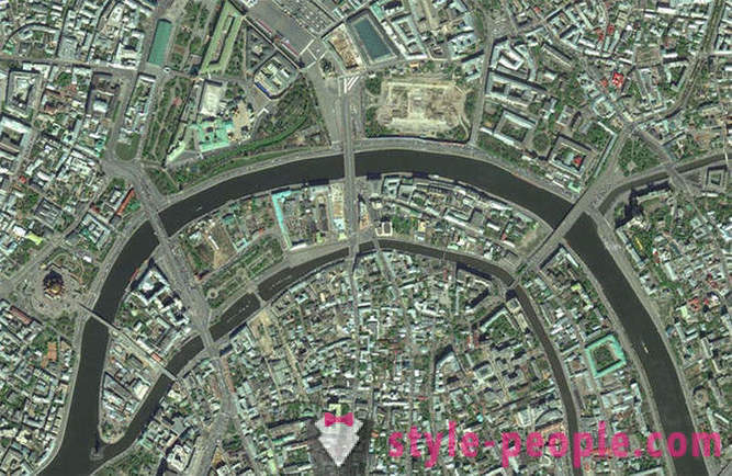
Have you ever wondered why more and Ustyinsky Great Moscow River bridge as wide, although the two sides are limited narrow streets?
Big Ustyinsky bridge was supposed to be a continuation of the Boulevard Ring to the opposite side of the river. Future planned street at the site of the existing building (for which demolition would go a lot of historic buildings and churches). And withdraw the Boulevard Ring was in the place where the pedestrian is now (!) Patriarchal bridge (far left on the satellite image). But another bridge (Novospasskiy), leading straight to the residential development (in 1938 and underwent a radical reconstruction). He was to be the site of the New Boulevard Ring. But it did not.
In the south, the capital of New Boulevard Ring would go on the streets and Pavel Andreev Academician Petrovsky and would cross the Moskva River at the place where now is located the pedestrian Pushkin (St. Andrew's) bridge. In the north of the capital in one ring alone would have coincided with the modern Third Transport.
Master plan 1935 and provided for the creation of another district magistarali: the Park ring, coincide completely with the Small ring of the Moscow railway. It turns out it was the real Stalin "Lord of the Rings", and Luzhkov is not that easy to implement some revised master plan in 1935.
In general, our beloved capital of the twentieth century developed quite randomly in a strange way. Judge for yourself: the general plan of 1935 was not implemented fully. The next master plan in 1971 for the last 20 years of the Soviet also had not been fully implemented. Luzhkov General Plan (2010) went to the scrap followed by the mayor will approve it. It is very interesting what will be the new development plan of the capital, and how it will be executed. By the way, let it be known that the current chord line not invented by the current urbanists, and borrowed from the general plan of 1971! That's how we live...
But back in the mid-twentieth century. After the war, a general plan in 1935 decided not to return, and they would have had we are highway between GUM and the Kremlin. By the way, before the 60-ies carried automobile traffic on Red Square:
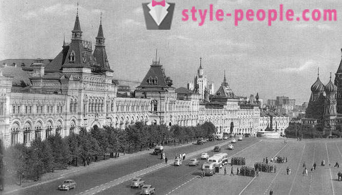
Photo from the book "Moscow. The planning and building of the city. 1945-1957"
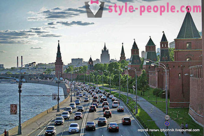
Today, from the Big Ustinsky, Greater Moscow River and Big Stone Bridge on 100% load running just the latest. Cars coming from the continuous stream of Leninsky Prospekt encircle the Kremlin and go on Tverskaya Street and Theater Lane. It was Stalin's general plan laid the destructive transit traffic through the center of the capital, which we are now seeing ... Car correspondence in Moscow are designed in such a way that the plug at the Kremlin walls can contemplate day and night at any time of the year!
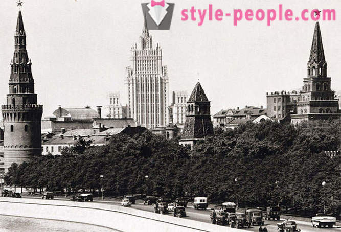
And do not say something that was not true. All the same, only the cars were smaller.
Of course, we must not think that the reconstruction of Moscow 30s brought only harm. It is obvious that the old streets and bridges could not cope with the ever-increasing human and streams. Therefore, the restructuring was necessary. Here, for example, the old Crimean bridge. It is obvious that it had to be reconstructed.
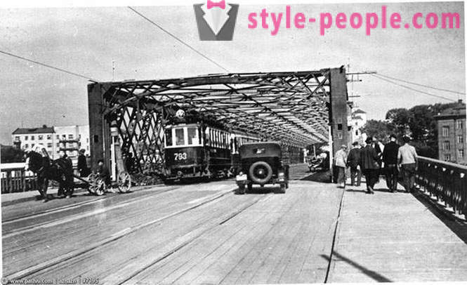
1936
And by the way, it turned out very well:
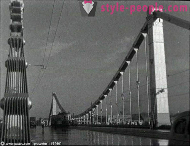
1938.
Now no tram on the bridge there, all 6 lanes given cars. And yet this place has long exhausted its capacity. Crimean bridge - this is the most narrow part of the Garden Ring.
But now again we are faced with choosing the path of development of Moscow. It is obvious that modern street and road network can not cope with the current workload. Actually, we have 2 options:
1. Stalin. With the transformation of the central (and not only) in a broad street mains, with demolition of houses, trees and lawns seaming in asphalt and t. D.
2. Harnessing the unlimited car traffic in the city (especially in the center).
Let's make the right choice!


- Most popular
-
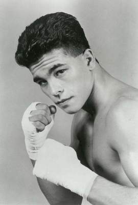 Arturo Gatti: Biography, cause of death
-
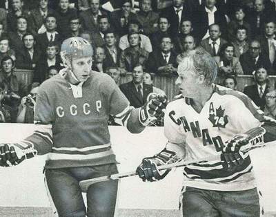 Alexander Gusev: photos, biography, sports career, interesting facts
-
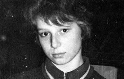 Tatiana Tarasova: biography, personal life, photos
-
 Dress code: types and rules. Description of the main types of address of code and practical advice on compliance with all the rules.
-
 What is Zumba-Fitness? ZUMBA - Dance fitness program
-
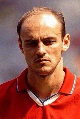 Viktor Onopko, football player: biography, personal life, sports career
-
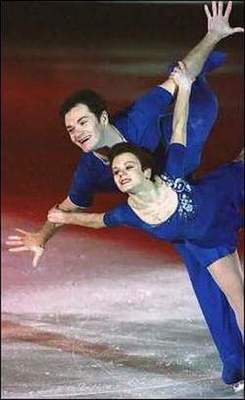 Maria Petrova - skater, a teacher and mother
-
 Ronnie Coleman: Biography, interesting facts of life
-
 Pink manicure with white: design ideas
-
 Baked powder "Pupa": reviews, palette, applying the rules. powder Pupa
-
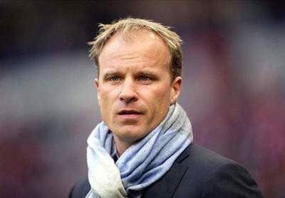 Dennis Bergkamp - Dutch football coach. Biography sports career
-
 Paint Igora Royal: color palette
-
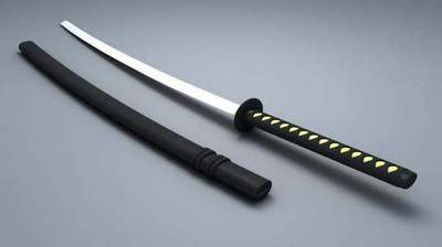 Japanese sword: name, types, production, photos
-
 Beautiful makeup day. How to make a day makeup for gray eyes?
-
 Haircut cascade on short hair: new image